Greater Shirekeep Map

Moderators: (Shireroth) Prefect of Shirekeep, (Shireroth) Court Historian, (Shireroth) Steward, (Shireroth) Kaiser

Post Reply
User avatar
Mira Octavius-Aryani
Posts: 1325
Joined: Thu Dec 12, 2013 7:25 pm

Greater Shirekeep Map

Post by Mira Octavius-Aryani »

Through the efforts of our esteemed King of Goldshire, Ryker:

Image

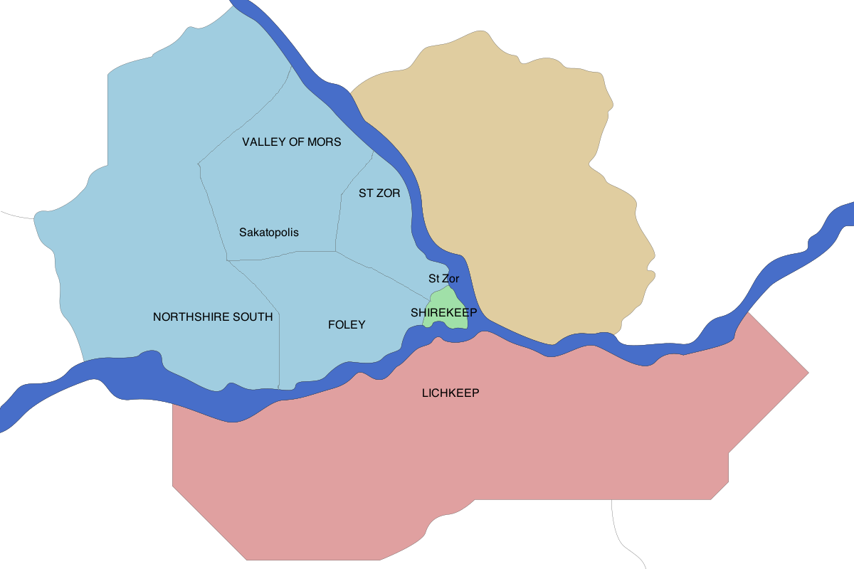
Green: Inner Shirekeep
Yellow: Kabeshire (County of Ynnraile, Goldshire)
Red: Lichbrook Grant
Blue: Elwynnese Grant

It's a first step that will be revised and have detail added to it as time goes on. In order to help facilitate that, if people could indicate where on here were the old Elwynnese bailiwicks and any established major sites/settlements/etc?

kthnxbai

Count Palatine of Kezan
Khanum of Cabbagefall

Kaiser Ayreon IV
AHS (Ayreonist Horror Story)
Posts: 902
Joined: Sat Jul 08, 2017 9:46 pm

Re: Greater Shirekeep Map

Post by Kaiser Ayreon IV »

Image

How I envision it

SAINT ZOR
- mostly urbanized
- has the train/underground hub station

FOLEY
- mostly urbanized
- has the Shirekeep Airport

VALLEY OF MORS
- less urbanized, includes large areas of nature in the interior
- has several cities (densely populated, but separated from one another), most famous in the interior is Sakatopolis, just south of the actual Valley of Mors (in the mountains) where many kaisers are buried

NORTHSHIRE SOUTH
- several cities and towns, separated with cultured land
- Another airport here
Ayreon IV
Former Kaiser of Shireroth (now dead)
RIC

User avatar
Mira Octavius-Aryani
Posts: 1325
Joined: Thu Dec 12, 2013 7:25 pm

Re: Greater Shirekeep Map

Post by Mira Octavius-Aryani »

I can work with these lines.

Count Palatine of Kezan
Khanum of Cabbagefall

Post Reply

Return to “Shirekeep Reconstruction Commission”